


EFB MSFS2024 VFRNAV v0.2.1
This is a pluggin for Microsoft simulator 2024 embeded EFB.
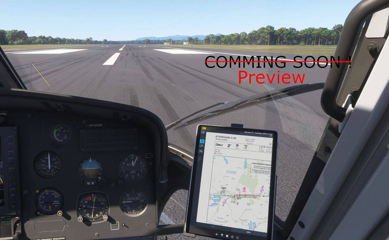
– Enroute chart reader (VAC/pdf/…) [preview]
– VFR Maps (OACI/Bing/Elevation/OpenStreetMap) (without aircraft position !!)
– Flight Plan(s) over the map
– Navlog based on map flight plan(s) [next release]
Only VFR Layers are now displayed by default ==> go to the settings page to add other layers.
The latest release now contains a partial support for PDF Vac charts.
Microsoft is using a very old browser release (Chrome 49, we are now at Chrome 134…) making integrating pdf a really pain ! Their is still some issues to be corrected (as described below) but they stays minor and must not disturb your flight.
Please carrefully read the below known issues section.
What’s implemented :
– PDF Viewer
– VAC Charts download from SIA web site
– Wheel for scrolling
– Ctrl + wheel for horizontal scrolling
– Alt + wheel for zooming
What’s on the board :
– Upload of PDF/image files from your computure (MSFS doesn’t yet provide the windows api, I will add an external program to overcom this issue leaving the possibility to use this plugin without it)
– Drawing over the PDF
– Meteo TEMSI download from aviation.meteo.fr
– Meteo Weather fronts download from aviation.meteo.fr
– Navlogs
– AZBA layer
– Fix repeated pattern (see below)
– Brasil/UK/… layers (on the way)
– Airport metar/informations on the map in the same way as SIA website
– And more ….
Known issues :
– Font loading detection isn’t working well (during the first render), in case of font issues, please zoom in/out the pdf in order to force a new rendering.
– Drawing a repeated pattern isn’t supported by MSFS, I have done a temporary workaroud in order to deactivate it.
==> Prohibited zone will be displayed only with a red stroke (without shaded) (see issue.png in user gallery at the bottom of this page)
– Time to time rendering may be incorrect, in this case please zoom in/out the pdf in order to force a new rendering.